
Surveying & Engineering
Kordil provides integrated land, nearshore and offshore surveying services covering hydrography and bathymetry, oceanography, sub-bottom and seismic investigations, magnetometer surveys, meteorological measurements, geodesy, photogrammetry, geophysics and geology. We also develop custom positioning and machine-control systems for excavators, dozers, graders, cranes, wheeled and tracked construction machinery, vessels, barges, offshore platforms, caissons, pipelines, underwater robots and unmanned surface vessels using GNSS, mechanical, electromagnetic and acoustic positioning technologies. Established in Türkiye in 2009 by professionals with extensive international industry experience, Kordil has grown continuously by delivering reliable surveying and engineering solutions without compromising technical quality, operational safety or professional integrity.
Offshore Surveying
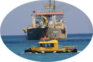
Hydrographic and offshore surveys covering bathymetry, oceanography, meteorology, sub-bottom profiling, seismic investigation, side-scan sonar, magnetometer surveys, seabed classification, sampling and borehole support.
Engineering Survey
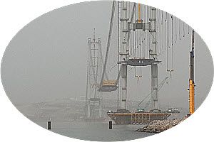
High-precision engineering surveys covering geodesy, geophysics, geology and photogrammetry, supported by qualified personnel and professional equipment for construction control, deformation, deflection, settlement and structural monitoring.
Positioning Systems
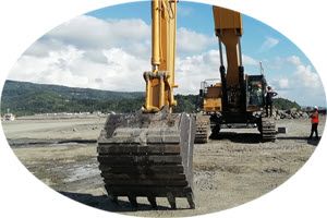
Custom positioning and machine-control systems for excavators, dredgers, cranes, drilling and piling rigs, graders, dozers, vessels, offshore machinery, ROVs and unmanned survey platforms.
What to include in your enquiry
Tell us the project location, approximate survey area, service required, expected deliverables and preferred timeframe. If available, include the required accuracy, coordinate system and site or water-depth information. For equipment enquiries, specify the product and intended application. If the scope is not yet defined, describe the project and the decision your survey needs to support.
Our Featured Systems
Synapse H Gradiometer - Marine Magnetics
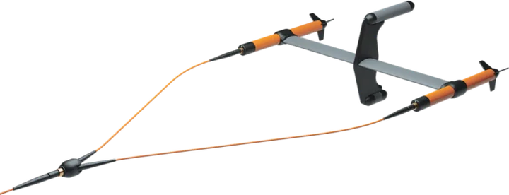
Marine Magnetics Synapse is a high-performance marine magnetometer and synchronized gradiometer array designed for UXO investigation, route clearance, pre-dredging surveys and the detection of ferrous objects buried beneath or located on the seabed. Its modular design supports single-sensor operation or synchronized arrays of up to 30 nodes.
Kordil GNSS-H4 GNSS Heading & Position with PC and Software
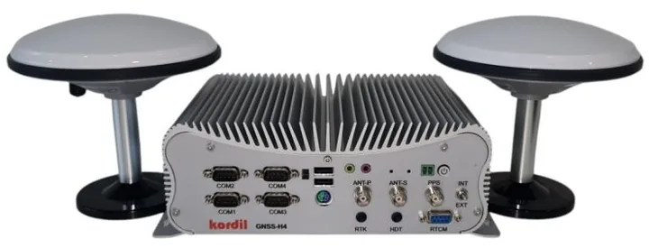
Kordil GNSS H4 offers multi-frequency and multi-constellation support by default, ensuring robust satellite coverage and precision positioning. Its dual-antenna configuration delivers reliable, industry-standard heading and positioning performance even in challenging environments. The system is powered by a built-in high-performance PC running Kordil Navigation Pro and is equipped with an Intel Core i7 processor, 32 GB RAM, and Windows 11 as the default operating system. Rigorously tested in harsh environments where most receivers fail. The system is an excellent solution for multibeam bathymetry and other high-accuracy GNSS applications.
LinkQuest FlowQuest 600 kHz ADCP Current Profiling System
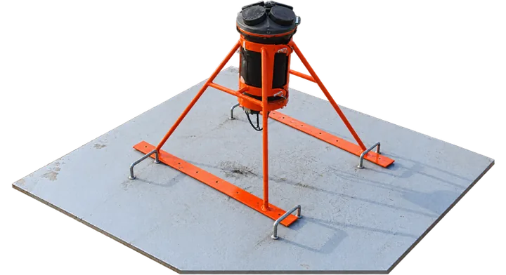
LinkQuest FlowQuest 600 kHz ADCP uses acoustic Doppler technology to measure current speed and direction throughout the water column. Installed on a seabed platform, it supports long-term oceanographic monitoring and current-regime studies for coastal and harbour projects.
- 600 kHz operating frequency and current profiling range up to 100 m
- Selectable measurement cells from 0.5 to 4 m
- Optional WaveQuest for directional wave spectrum measurements
Kordil deployed the FlowQuest 600 kHz ADCP on the seabed in the Çanakkale Strait for a one-year current-regime investigation.
Coastal Surveyor - Hydrographic Survey Vessel
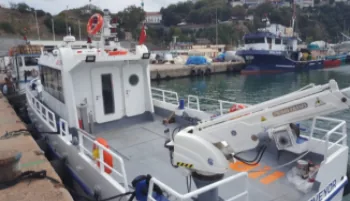
Coastal Surveyor counting down to being launched. The survey vessel was designed to do surveys at near shore and even in offshore. During construction process, everything is designed for surveyors and survey teams, in terms of speed, maneuverability, cable routes, daily basis installations, antenna and radio poles, free cable inlets, heating, and cooling. The vessel was equipped with to do all kinds of offshore, near shore and surf zone surveys. Designed by surveyors for surveyors.
Kordil EPS – Excavator Positioning with 2D and 3D Visualization
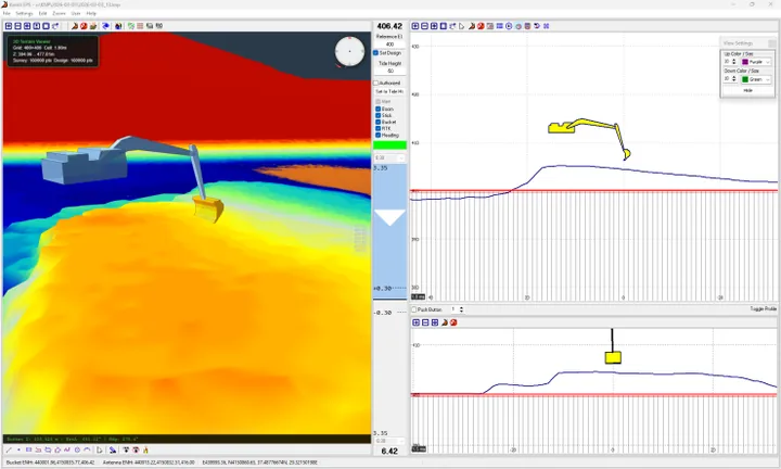
Kordil EPS now provides both 2D and 3D visualization for excavator positioning. Complex 3D designs that were previously displayed through simplified 2D views can now be inspected using the completed three-dimensional visualization module.
Continuously developed by Kordil, the system supports operators working on offshore construction and excavation projects with clear positioning and design information. The updated visualization helps teams review the machine’s relationship to the project model during operations.
AML-6 Multiparameter Oceanographic Survey
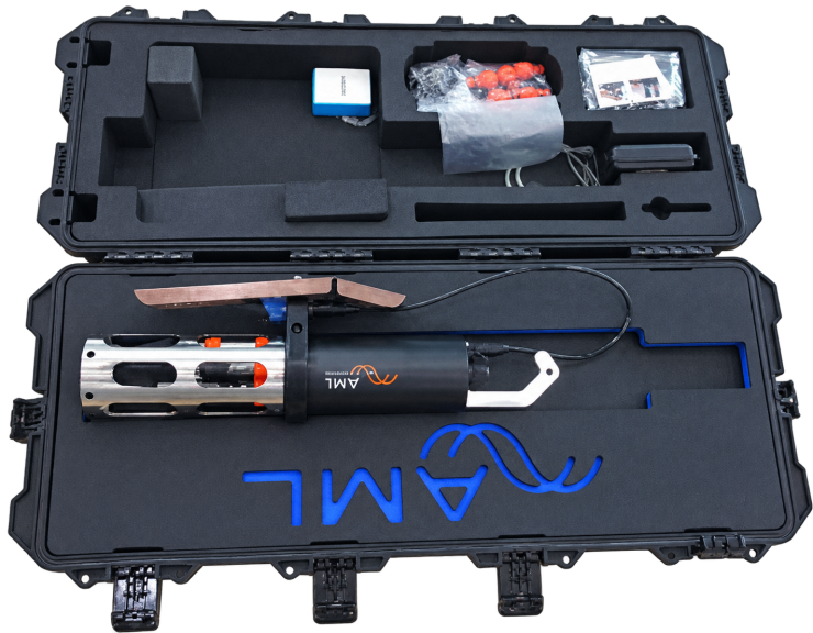
New design turbidity for measuring conductivity, temperature, depth, salinity, density, pH, dissolved oxygen, sound velocity, and resistivity on a water column. The instrument is in our stocks.
DJI Matrice 350 RTK, Zenmuse L2 and P1
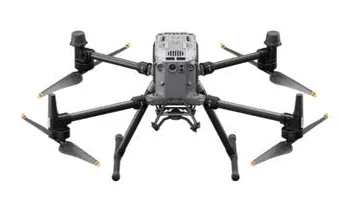
The DJI Matrice 350 RTK survey platform combines aerial LiDAR and photogrammetry capabilities with interchangeable Zenmuse L2 and P1 payloads. Zenmuse L2 records up to 1.2 million points per second in multiple-return mode, with up to five returns for terrain and vegetation mapping. Its 20 MP mapping camera complements the laser data.
The Zenmuse P1 features a 45 MP full-frame camera for detailed orthophotos, 3D models and engineering surveys. Kordil uses these technologies for topographic mapping, construction monitoring and infrastructure documentation.
CHCNAV RS10 Handheld SLAM LiDAR
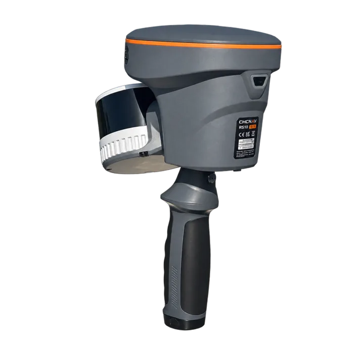
The CHCNAV RS10 combines SLAM laser scanning, RTK GNSS positioning and three 5 MP cameras in a portable mapping system. It captures three-dimensional point clouds while the operator walks through indoor and outdoor environments, supporting building surveys, industrial facilities, infrastructure and terrain documentation.
The 32-line configuration offers a maximum range of 300 m and up to 1.92 million points per second with triple returns; performance depends on reflectivity and survey conditions. Integrated imagery helps teams interpret and colour the point cloud for measurements, modelling and as-built documentation.
Shark-S75T Deep-Water Triple-Frequency Side-Scan Sonar
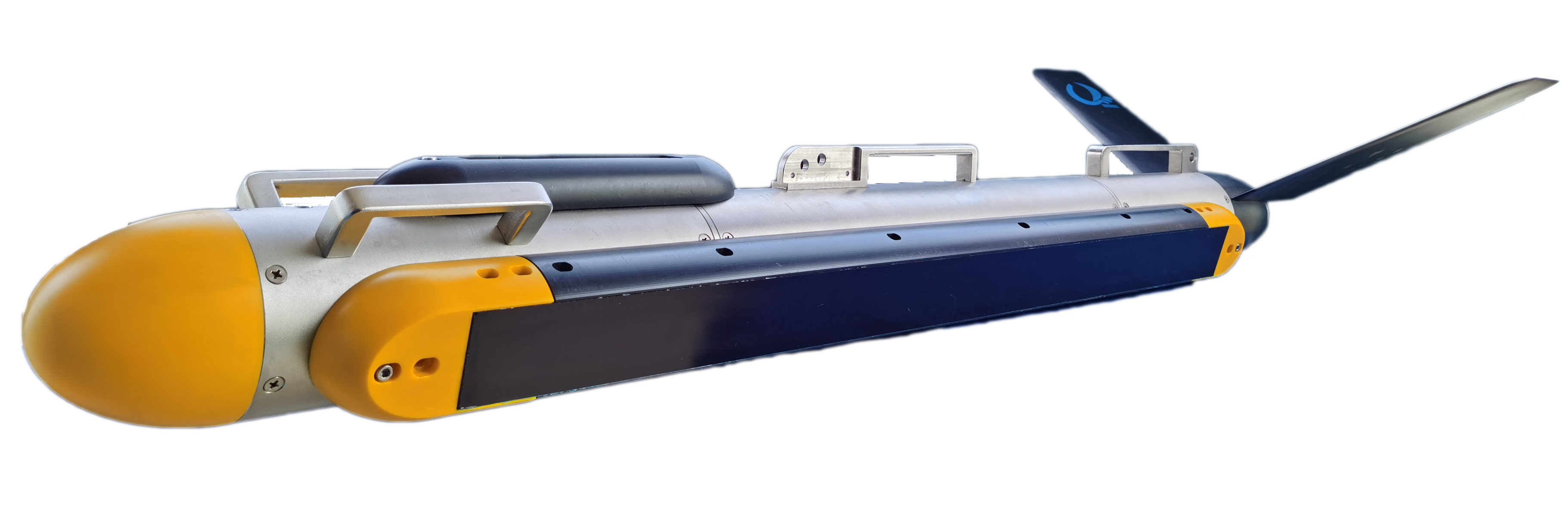
The LCSonar Shark-S75T combines 75, 225 and 750 kHz frequencies for wide-area seabed mapping and detailed underwater target inspection. Selectable 75/225 kHz and 225/750 kHz combinations support coastal and deep-water geophysical surveys, cable and pipeline investigations, and wreck searches.
The 316L stainless-steel towfish has a standard 2,000 m depth rating and integrates bottom tracking, attitude and pressure sensors. LFM CHIRP and CW transmission modes, real-time sonar mosaicking and standard XTF recording support flexible survey and processing workflows.
GEM Systems GSMP-35G Potassium Gradiometer
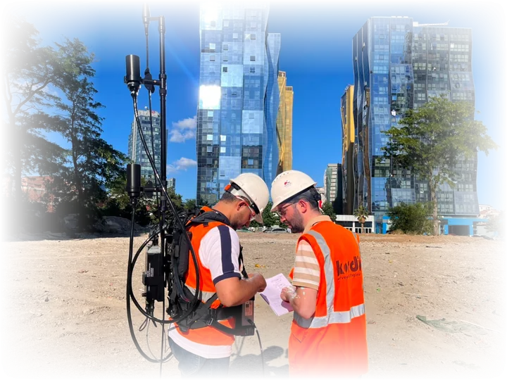
The GSMP-35G is a portable potassium gradiometer for ground magnetic surveys, geological mapping, archaeology and UXO target identification. Optically pumped potassium technology supports precise magnetic-field and gradient measurements, with GPS navigation options and GEMLink+ data processing software.
- Sensitivity: 0.0002 nT at 1 Hz
- Absolute accuracy: ±0.1 nT
- Sampling rates: 1, 5, 10 and 20 Hz
- Standard range: 15,000–120,000 nT
EdgeTech 3400 Subbottom Profiler
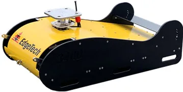
We are happy to announce another top grade subbottom profiler system in our inventory waiting for customers. Edgetech 3400 is a wide band frequency modulation (FM), CHIRP subbottom profiler operating in 2-16 kHz. EdgeTech 3400 is a subbottom profiler that uses EdgeTech’s registered Full Spectrum CHIRP technology with Frequency Modulation suitable for most offshore construction and research projects with high quality imaging of strata down to 80 meters from the seabed. The system has a ready to use pipeliner mode suitable for surveying pipelines and cable lines with high ping rate.
NORBIT Subsea Multibeam Sonar Systems
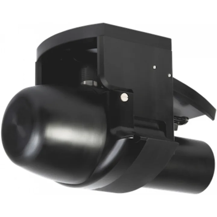
NORBIT is the world's one of the best-selling mobile multibeam echosounder underwater measurement systems. It delivers world-class sonar technology through two powerful multibeam series. The WINGHEAD offers ultra-high-resolution bathymetry and imaging, while the WBMS series packs industry-leading performance into the world’s most compact and low-power multibeam platform.
Obscape Real-Time Environmental Monitoring Solutions
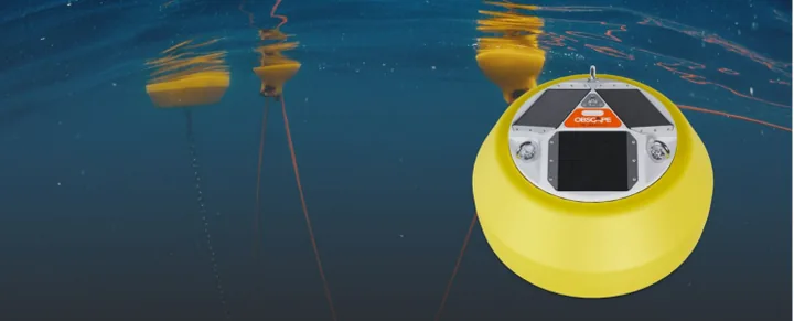
Obscape offers high-quality environmental data accessible, simple, and affordable, the company provides integrated systems that combine robust field equipment, solar-powered autonomy, and real-time cloud connectivity. Designed for remote deployment and built to withstand harsh environmental conditions, Obscape systems support timely and informed decision-making in dynamic environments.
Obscape’s product range includes:
- Wave monitoring systems
- Current monitoring solutions
- Water quality monitoring
- Time-lapse cameras
- Flow gauges
- Wave gauges
All devices are connected to the Obscape Data Portal, where real-time data can be visualized, analyzed, and managed. The platform offers automated alerts, remote device diagnostics, and customizable reporting to streamline monitoring operations.
Argos - Gradiometer for Divers
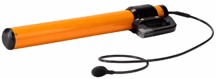
Marine Magnetics Argos is a compact diver-held gradiometer designed for underwater detection and precise relocation of buried ferrous objects. Real-time visual and audio guidance leads the diver directly to the target, making Argos ideal for UXO verification, salvage, underwater archaeology, harbour inspections and subsea debris clearance. Its lightweight, neutrally buoyant design enables easy operation by a single diver. Available for sale and demonstration through Kordil.
Geometrics G-882 Marine Magnetometer
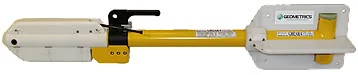
Geometrics G-882 Marine Magnetometer is a versatile tool for emergency response instrument for offshore and waters. The system is also suitable for debris cleaning, UXO research, route clearance, detecting ferrous objects in various sizes both buried and located on seabed. Geometrics G-882 is also only magnetometer meets with UXO research standards at North Sea.
Klein 4900 Side Scan Sonar
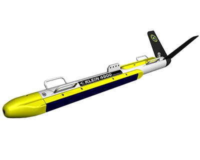
The Klein System 4900 is a portable, dual-frequency side scan sonar for detailed seabed imaging, coastal surveys and search and recovery operations. Simultaneous 455/900 kHz operation combines wide-area detection with high-resolution target inspection.
Broadband CHIRP and selectable CW transmission modes support clear seafloor imagery. The stainless-steel towfish is rated to 300 m depth and includes heading, pitch, roll and pressure sensors for survey operations.
Applied Acoustics Easytrak Pyxis USBL
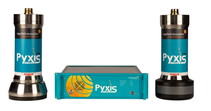
Applied Acoustics Pyxis INS + USBL is a fully integrated, inertially aided underwater positioning system designed for accurate, survey-grade subsea tracking. It combines Applied Acoustics’ Sigma 2 spread-spectrum acoustic technology with the high-precision SBG Systems Navsight Apogee Marine INS.
The closely coupled, factory-calibrated system provides stable positioning while significantly reducing mobilisation and calibration time. Directional and omnidirectional transceiver options make Pyxis suitable for shallow-water, horizontal and long-range tracking operations.
Innomar Parametric Subbottom Profiler
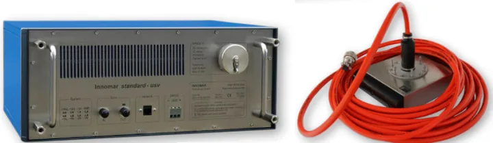
With over 25 years of experience, Innomar is a leading company in the development of parametric sub-bottom profiler (SBP) systems. These systems provide high-resolution imaging of sub-seafloor structures and buried objects. They are widely used in applications such as geophysical surveys, pipeline and cable detection, dredging and port operations, marine archaeology, and UXO investigations. Operating with narrow acoustic beams, Innomar’s SBP systems deliver high-resolution sub-bottom data with excellent penetration. Their broad product range addresses diverse operational needs, from shallow water to deep-sea environments. Compact models, with their lightweight and low-power design, are ideal for integration with USVs, enabling safe and effective data collection in hard-to-reach or hazardous areas.
Ping DSP Combined Multibeam & 3D Side Scan
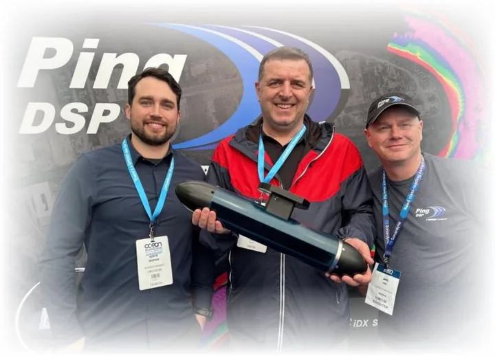
Ping DSP offers groundbreaking solutions for underwater mapping and structural inspection through advanced hydroacoustic imaging technologies. Best known for its 3DSS-DX series of 3D Side Scan Sonar systems, Ping DSP is specifically designed to meet the demands of high-resolution, real-time, and three-dimensional underwater imaging.
With advanced signal processing and SoftSonar™ technology, the system delivers clear and detailed visual data even in complex underwater environments. This enables users to move beyond conventional 2D surveys and perform comprehensive 3D analysis of site conditions—saving both time and cost.
Ping DSP systems are fully compatible with industry-standard software such as Hypack, SonarWiz, CARIS HIPS/SIPS, and QINSy, making data acquisition and analysis seamless and efficient.
DeepVision Equilibrium SSS
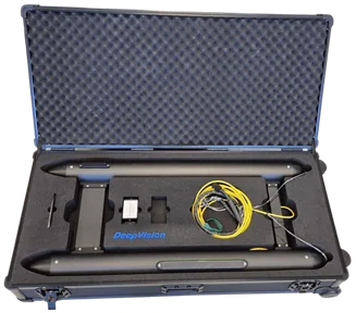
Equilibrium Neutral Towfish 340/680 kHz is a neutrally buoyant, highly stable side-scan sonar designed for cable tracking, mine and UXO detection, wreck search and other applications requiring high-resolution seabed imagery.
Features & Benefits
- Neutrally buoyant design for exceptionally stable towing
- High-quality imaging, including in shallow water
- Supports small weights or larger downforce wings
- Dual-frequency operation for wide-area search and detailed inspection
- Available in standard and Search and Rescue (SAR) versions
Key Specifications
- Frequencies: 340/680 kHz
- Configuration: Neutral-buoyancy towfish
- Standard model: 1110 Equilibrium
- SAR model: 1112 Equilibrium
- SAR optimization: Modified 680 kHz signal strength, filters and beam angles for locating drowning victims
- Recommended standard applications: Cable tracking, mine/UXO detection and wreck search
Norah - Hydrographic Survey Vessel
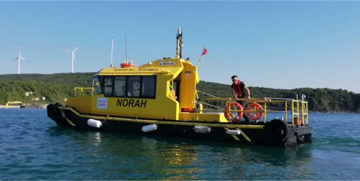
Norah is a highly versatile hydrographic survey vessel, expertly designed for both construction and coastal survey operations. With its well-thought-out interior layout and robust structural design, Norah is fully equipped to serve as a premier platform for multibeam, hydrographic, and oceanographic survey.
Leica RTC360 3D Laser Scanner
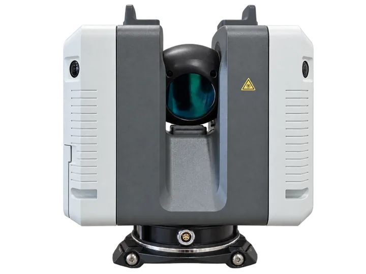
The Leica RTC360 captures detailed three-dimensional measurements for building documentation, BIM, industrial installations and engineering surveys. With a measurement range of 0.5–130 m and a scanning rate of up to two million points per second, it records dense point clouds efficiently.
HDR panoramic imagery adds visual context, while the Visual Inertial System (VIS) supports automatic pre-registration between scan positions. Kordil combines field scanning and data processing to document existing conditions, inspect structures and prepare reliable measurements for design and construction teams.